The scale representation and coordinate determination tool is located in the lower left corner of each thematic map.
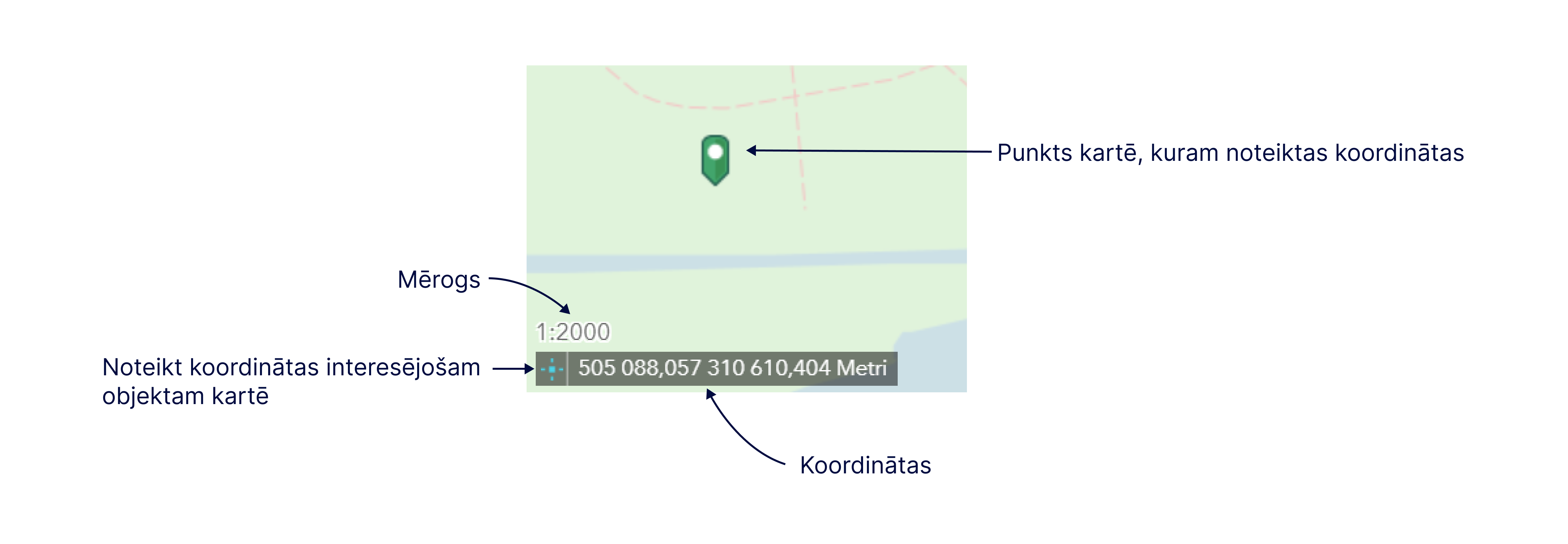
Scale – the numerical scale shows the ratio between the distance on the map and the distance in nature. The scale changes automatically when you zoom in or out of the map view.
Coordinates – when moving the mouse cursor over the map view, the coordinates also change according to the position of the cursor. To determine the location coordinates of the object of interest, click the location symbol to the left of the coordinate record to enable clicking the map to obtain coordinates. Once this is done, you need to click the object of interest in the map view: the symbol of the marked place will remain on the map, and the specified coordinates of the object will appear in the coordinate entry window.
Please note! GEO RĪGA thematic maps use the Latvian 1992 geodetic coordinate system in Transverse Mercator projection (LKS-92 TM).