The initial view of GEO RĪGA contains thematic maps or apps that have collected information on the specific topic.
By clicking the thematic map button with the mouse cursor, you will open the map browser, where you can view the relevant geospatial data and perform other actions with them, such as data selection, data compilation prints, etc.
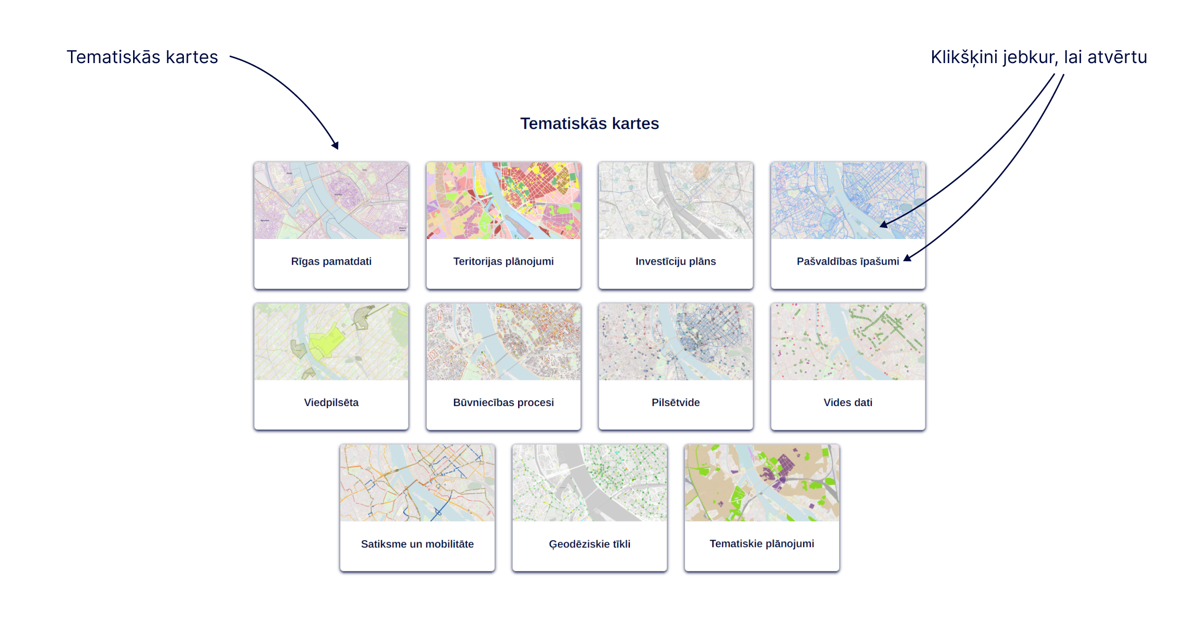
Content of thematic maps
The Riga Basic Data map summarises the basic information about the administrative territory of the city of Riga – administrative boundaries, streets and addresses, boundaries of urban districts and neighbourhoods, cadastral information, red lines, functional zoning map of the effective territory plan, current orthophoto map and others. These data layers are also available on other maps for matching with the thematic data layers.
The thematic map Territorial Planning displays annexes of the effective Riga territorial plan (RTP) – functional zoning, territories with special regulations, protective zones, vector data of territory use and construction regulations (TIAN) and map data of explanatory text, and others. The Riga territorial planning was approved on 15.12.2021 by Riga City Council decision No. 1091 “On the approval of the territorial planning of Riga”. Likewise, this thematic map shows data layers of the graphic part, boundaries of local plans and detailed plans and information about the boundaries of objects of national interest, as well as the territorial planning of the Riga Historical Centre (RVC) and its protection zone. The territorial planning of Riga for 2006–2018, – 2018. which has ceased to be in force, is also available.
The Investment plan map displays the Investment Plan (IP) of the Riga Development Program for 2022–2027 – 2027. (AP2027) which forms a link between municipal development planning and the budget. The depicted IP projects are infrastructure projects in a specific location of the city. They are grouped according to the priorities defined in the Strategic Part of AP2027.
The thematic app Municipal Properties gradually publishes information about the immovable property of the Riga City Municipality and of the capital companies of the Riga City Municipality, and transactions with municipal immovable property.
The map Geodetic Networks provides information about the points of the local geodetic network of Riga – names of points, location in the area, geodetic characteristics, photographs of the points, protective zones around the geodetic points and geodetic network scheme. The thematic map will also be supplemented with other data relevant for the performance of geodetic works, such as points of the national geodetic network, GNSS usage areas in Riga, the Riga quasi-geoid model RIGA’20 and others.
The thematic app Environmental Data collects spatial information about various types of pollution in Riga, as well as waste management data, the city’s venerable tree database, specially protected natural areas and other data related to environmental quality.
Riga bicycle infrastructure data, including the planned bicycle infrastructure, public transport routes and stops, and other information related to traffic in the administrative territory of the city of Riga is available on the thematic map Traffic and Mobility.
The map Urban Environment will gradually collect data on objects comprising the municipal urban environment in Riga’s public space – advertising hoarding, playgrounds and active recreation areas, environmentally degrading structures, etc. There will be also information on issues such as municipal pavement cleaning services and other issues pertaining to the urban environment.
The Thematic Planning map displays the thematic plans developed by the Riga City Municipality for the preparation of the Riga territorial planning. The Thematic Planning analyses various urban planning issues in line with the city’s policies in terms of territory use, setting tasks and justifying the solutions of the Riga territorial planning. You can find out more about the thematic planning on the website of the City Development Departmen.