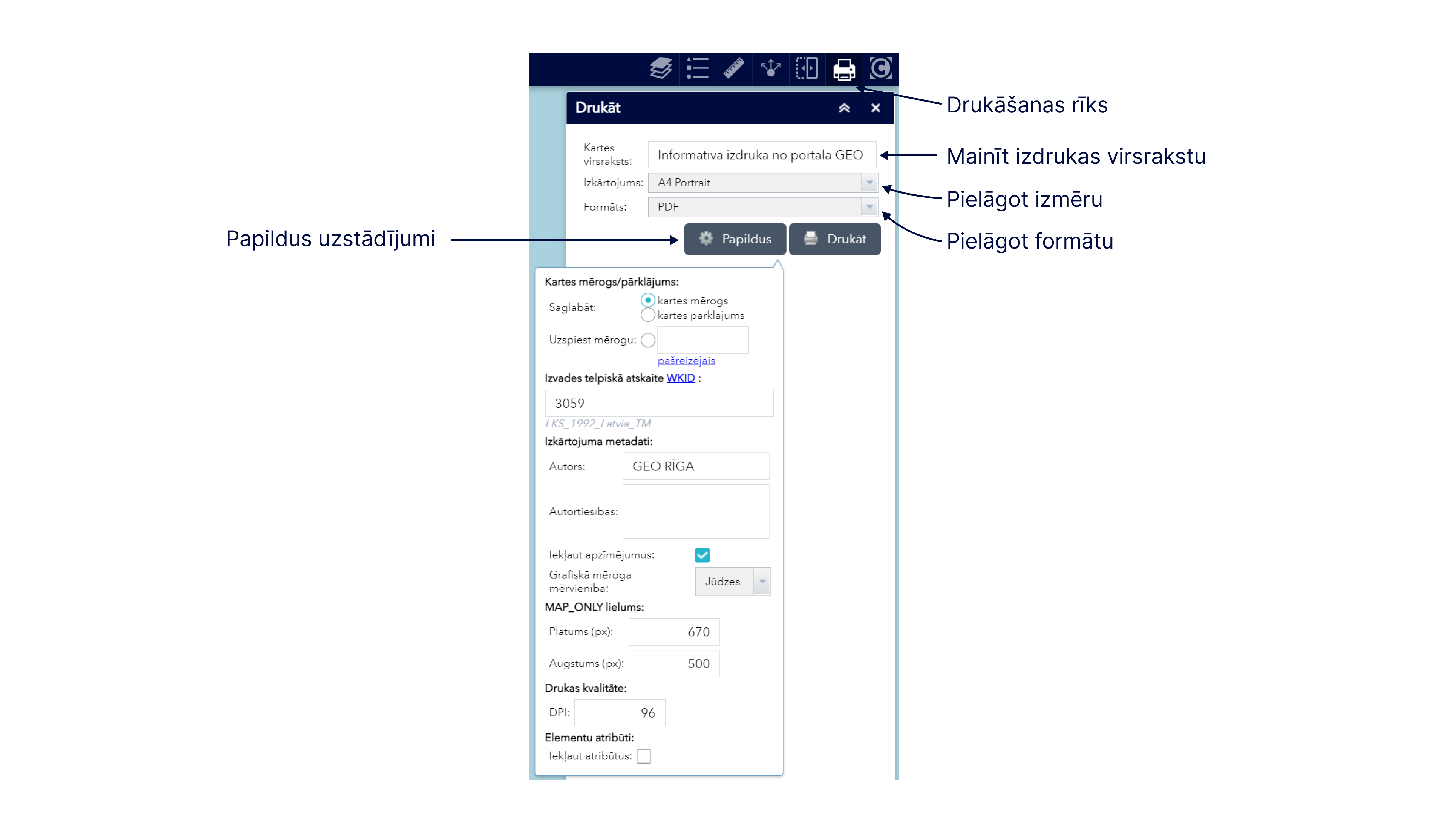
The Print tool as the sixth default tool is available on the upper right side of each thematic map in the line of specific tools and allows the user to create a map printout displayed on the screen or its fragment by defining the necessary printout settings.
When you enable the print tool by clicking it, the print settings widget is displayed, where you can change the default print settings – map name, print size and layout, format and others.

Please note! If the default settings are not changed, then the map printout will be created in A4 portrait layout in *.pdf format, and the printout will have the heading Informative printout from the GEO RĪGA portal.
In addition to the standard settings, by pressing the button Advanced in the print settings widget, it is possible to define specific print settings – define scale, indicate the author of the map printout, uncheck the inclusion of symbols in the printout, specify the scale measurement unit, etc.
Please note! You will not be able to make entries about the copyright of the data used. The copyright will be displayed automatically in the printout, considering the data layers used in the printout from the thematic map of the GEO RĪGA portal.
By pressing the Print button in the print settings widget a map printout in the device’s screen view is created containing the active data maps within it. When you open a printout, you can download it and save it to your devices, or send it for printing.
Please note! If you want to include a large amount of data from many data layers in one printout and print large areas, then the printout may not include all the symbols of the used data, and the printing may take a long time.
Please note! While using the thematic map, printing is possible multiple times with different active data layers and print settings and the printouts will be saved in the print widget as a list. After restoring the thematic map, closing it and re-opening it, the previous prints will no longer be available.
