News
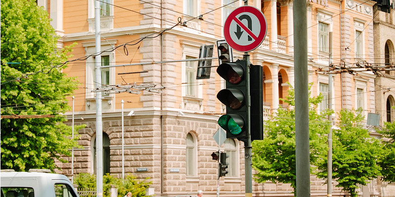
Traffic light locations
30.03.2026
In the GEO RĪGA thematic map Traffic and Mobility, under the section Street Infrastructure, information is available on the locations of traffic lights on the streets of Riga, as well as on the sites where new traffic lights are planned to be installed in the near future.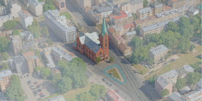
Share your opinion about the square at the intersection of Cēsu Street and Brīvības Street
25.03.2026
In the Engage section, a survey has been published in which residents are invited, until 27 April, to share their opinion about the square opposite St. Gertrude New Church at the intersection of Cēsu Street and Brīvības Street. The aim of the survey is to identify necessary improvements in the area by gathering public opinion and assessing satisfaction with the current situation.
Tīmekļa vietnē tiek apstrādātas tikai nepieciešamās sīkdatnes, kas ir būtiskas, un ļauj piekļūt dažādām tīmekļa vietnes daļām. Nepieciešamās sīkdatnes tiek saglabātas Tavā datorā, viedtālrunī, planšetdatorā vai citā ierīcē vietnes apmeklējuma un pārlūkošanas laikā vai noteiktā laika periodā. Šīs sīkdatnes ir nepieciešamas tīmekļa vietnes darbībai, tāpēc tās nevar izslēgt, un tādēļ lietotāja piekrišana šai sīkdatņu kategorijai netiek prasīta.
This content is blocked. Accept cookies within the '%CC%' category to view this content.